
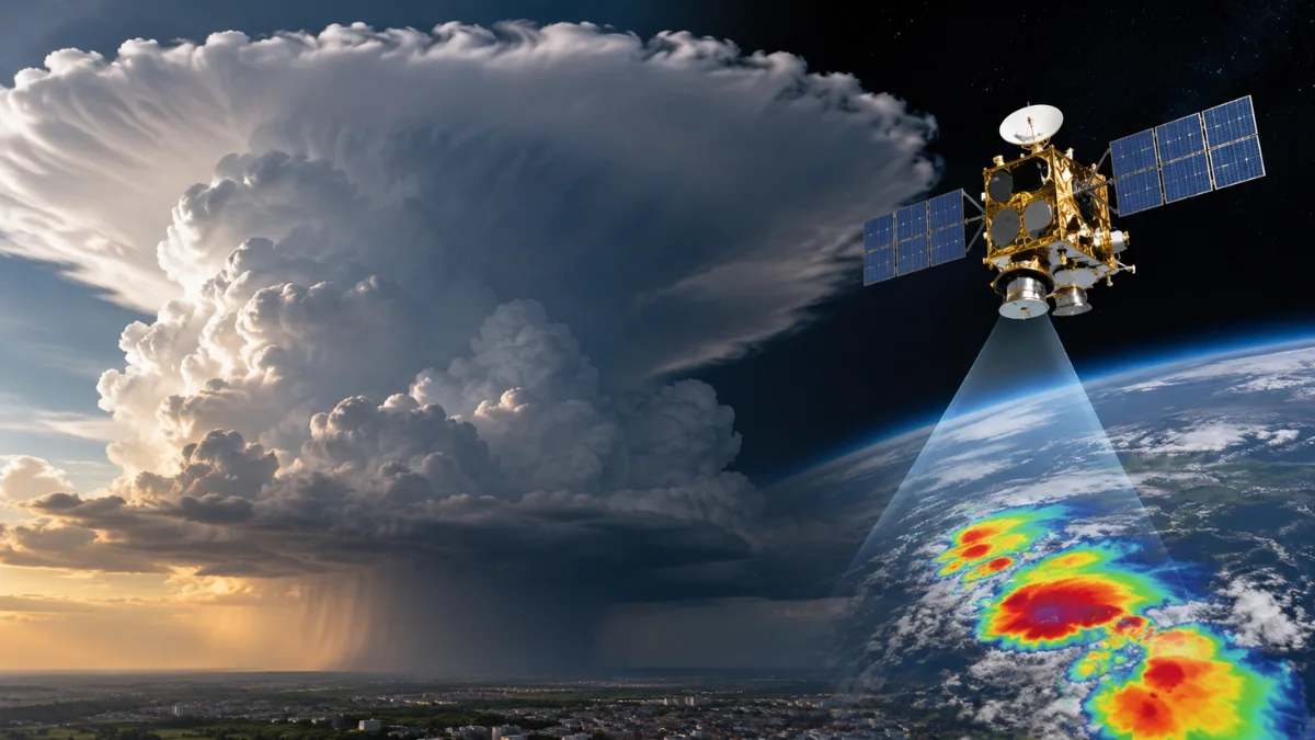

Cloud tops over India can reach temperatures close to −90°C because powerful monsoon thunderstorms rise into extremely cold parts of the upper atmosphere. The figure does not describe the temperature on the ground or even the temperature throughout the entire cloud. It describes the very cold upper portion of a towering convective cloud detected by a weather satellite.
This became especially noticeable in August 2026 when an official India Meteorological Department satellite bulletin reported minimum cloud-top temperatures of roughly −70°C to −90°C in several areas experiencing intense to very intense convection.
The temperature sounds extraordinary when much of India below remains warm and humid, but there is no contradiction. The ground and the top of a deep thunderstorm can sit many kilometres apart and experience completely different atmospheric conditions.
What Does a −90°C Cloud-Top Temperature Actually Mean?
Cloud-top temperature refers to the temperature associated with radiation coming from the upper portion of a cloud as seen by a satellite.
A weather satellite does not lower a thermometer into the storm. Its infrared instruments detect thermal radiation emitted from Earth, clouds and the atmosphere. Meteorologists use that signal to calculate what is known as a brightness temperature.
For a thick thunderstorm cloud, the infrared temperature can provide a useful indication of how cold its upper surface has become.
This means a reported cloud-top temperature of −90°C does not mean the entire thunderstorm is −90°C. The lower portions of the cloud are much warmer, and surface temperatures may remain above 25°C or 30°C at the same time.
The extreme cold exists near the top because the thunderstorm has grown very high into the troposphere.
Temperature normally decreases with altitude through most of this part of the atmosphere. A storm that reaches much higher levels therefore encounters much colder air than a shallow cloud.
That is why meteorologists pay close attention to exceptionally cold cloud tops. They can provide evidence that convection has become very deep.
How Can a Monsoon Thunderstorm Grow That High?
A strong monsoon thunderstorm develops when warm, moisture-rich air rises rapidly.
As the air moves upward, atmospheric pressure decreases. The rising air expands and cools, allowing water vapour to condense into cloud droplets. If enough instability and moisture remain available, the air can continue rising instead of quickly losing its upward momentum.
A vigorous updraft can carry cloud droplets, water vapour and ice particles through several kilometres of the atmosphere.
The upper parts of a mature thunderstorm eventually extend far above the levels where liquid rain first develops. At these heights, temperatures fall well below freezing and much of the cloud consists of ice.
Some especially powerful convective towers can approach the tropopause, the boundary near the top of the troposphere. The exact height and temperature of the tropopause vary with location, season and atmospheric conditions, but this region can be extremely cold.
A strong updraft may even push temporarily above the surrounding anvil before sinking back. Meteorologists call this protruding feature an overshooting top.
The important point is that a −80°C or −90°C cloud top is not created because surface air suddenly becomes extraordinarily cold. It happens because the thunderstorm transports moisture and cloud material upward into an atmospheric layer where such low temperatures are possible.
How Does INSAT-3DS Measure the Temperature?
India’s INSAT-3DS satellite observes the atmosphere from geostationary orbit, allowing it to repeatedly monitor the same large region.
According to ISRO’s description of INSAT-3DS, the satellite carries a six-channel imager capable of observing Earth in visible and several infrared wavelengths. It also carries a sounder designed to retrieve information about atmospheric temperature and moisture.
Thermal infrared observations are especially important for cloud-top temperature.
Every object with a temperature above absolute zero emits electromagnetic radiation. The amount and wavelength distribution of that radiation change with temperature. Satellite sensors can measure infrared energy and use it to estimate the brightness temperature of the surface or cloud from which the radiation originated.
A warm land surface therefore produces a different thermal infrared signal from the upper surface of a deep, icy thunderstorm.
INSAT-3DS has two thermal-infrared imaging channels covering approximately 10.2–11.2 micrometres and 11.5–12.5 micrometres, according to specifications published by India’s Meteorological and Oceanographic Satellite Data Archival Centre.
Unlike an ordinary visible photograph, this information does not depend entirely on sunlight. Thermal infrared instruments can observe cloud temperatures during both day and night, allowing meteorologists to follow thunderstorms after sunset as well as during daylight.
Why Does IMD Pay Attention to Very Cold Cloud Tops?
Cloud-top temperature gives forecasters a quick indication of the vertical development of convection.
In its satellite bulletins, IMD uses different cloud-top temperature ranges while describing the intensity of convective activity. In the August 7 bulletin, cloud tops below approximately −70°C were associated with very intense convection, while warmer temperature ranges were used for lower categories.
The connection comes from the structure of the atmosphere. Reaching extremely cold temperatures usually requires a cloud to extend into very high atmospheric levels.
A shallow rain cloud cannot normally produce the same extremely cold upper temperature as a powerful thunderstorm tower reaching toward the tropopause.
On August 7, 2026, IMD reported minimum cloud-top temperatures in the −70°C to −90°C range across parts of several regions experiencing strong convection. The observations showed meteorologists where unusually deep thunderstorm development was occurring.
The temperature therefore works as an important clue about storm structure.
It is not, however, a complete measurement of what the storm will do at the surface.
Does a −90°C Cloud Top Mean Extreme Rain Will Fall Below It?
Not necessarily.
An exceptionally cold cloud top can indicate powerful vertical development, but it cannot by itself reveal the exact amount of rainfall that will reach the ground at one location.
Rainfall depends on several factors, including moisture supply, storm movement, the internal structure of the cloud and how long the system remains over a particular area.
Meteorologists therefore do not make local rainfall assessments from cloud-top temperature alone. They combine satellite imagery with weather radar, rain gauges, atmospheric observations, forecasting models and other information.
This distinction also matters when interpreting official warnings.
A satellite may identify exceptionally cold cloud tops over a region, but that is different from an IMD public warning that communicates expected weather impacts. DesiVibe’s explanation of what IMD yellow, orange and red rain alerts mean covers how those warning levels should be interpreted.
Very cold cloud tops tell meteorologists something about the height and strength of convection. Warning colours tell the public something different: the level of weather risk that forecasters expect.
The two should not be treated as interchangeable.
Why Can the Coldest Part of the Cloud Spread Away From the Heaviest Rain?
When a thunderstorm reaches the upper troposphere, it cannot continue rising indefinitely.
The surrounding atmosphere eventually becomes much more resistant to vertical motion. Cloud material then begins spreading horizontally near the top of the storm, producing the broad, flattened structure known as an anvil.
This upper cloud contains large amounts of ice.
High-altitude winds can carry anvil material away from the original thunderstorm core. As a result, a satellite may detect a broad region of very cold cloud even though the strongest rainfall occupies a smaller area underneath.
This is one reason large areas of cold cloud in infrared satellite imagery should not automatically be interpreted as equally heavy rainfall across the entire region.
The satellite sees what is happening at the upper surface of the cloud. Rain gauges and radar help reveal what is happening closer to the ground.
The distinction becomes particularly important during the monsoon, when numerous thunderstorms can develop across different regions at the same time and their high cloud shields can expand far beyond their individual rain-producing cores.
Why Do −80°C and −90°C Clouds Look So Striking in Satellite Images?
Many weather satellite images circulating online are enhanced infrared images rather than ordinary photographs.
Meteorologists process infrared measurements so temperature differences become easier to identify. Very cold, high clouds can therefore stand out strongly against warmer surfaces and lower clouds.
The appearance is useful because it allows forecasters to quickly locate areas where deep convection may be developing.
A bright or strongly coloured cloud area in an enhanced infrared image does not mean the satellite has photographed ice glowing in the atmosphere. The colours or brightness levels represent processed temperature information.
This also explains why satellite images can sometimes look much more dramatic than the weather visible from the ground.
A person may see an overcast sky or distant thundercloud, while INSAT-3DS is simultaneously observing the temperature structure across the entire upper surface of the storm.
Because the satellite remains in geostationary orbit, meteorologists can compare successive images and watch cloud tops become colder, expand, weaken or disappear as thunderstorms evolve.
What Did the −90°C Reading Actually Tell Meteorologists?
The most accurate interpretation is that some thunderstorms had grown high enough for their upper clouds to reach atmospheric temperatures approaching −90°C.
The reading did not mean India itself had become that cold. It did not mean every part of the cloud was −90°C, and it did not guarantee extreme rainfall at every location below it.
It indicated exceptionally deep convection high in the troposphere.
That is precisely why thermal infrared observations from INSAT-3DS are valuable. They allow meteorologists to identify important characteristics of thunderstorms that cannot be judged from surface temperature or ordinary photographs alone.
A humid monsoon afternoon at ground level and a −90°C cloud top can therefore exist at the same time without being contradictory. They are measurements from two very different parts of the atmosphere, separated vertically by many kilometres.
The extreme number becomes understandable once the height of the thunderstorm is taken into account.
