
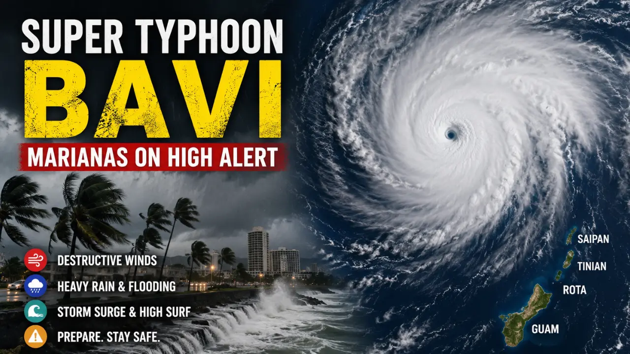

Super Typhoon Bavi has become one of the most serious weather threats in the western Pacific in early July 2026, with Guam and the Northern Mariana Islands preparing for dangerous winds, flooding rain, coastal flooding, and destructive surf. This article is based on official weather information available on July 5, 2026, and the situation can change quickly as the storm moves closer to the islands.
The National Weather Service in Guam reported that Super Typhoon Bavi was a very dangerous Category 4 super typhoon on Sunday, July 5, 2026, moving west-northwest toward the Marianas with maximum sustained winds near 155 mph. The storm was expected to pass near Rota on Monday morning, with Guam, Rota, Tinian, and Saipan under typhoon warnings.
What Is Super Typhoon Bavi?
Super Typhoon Bavi is a powerful tropical cyclone in the western North Pacific. In this region, the word “typhoon” is used for the same type of storm that is called a hurricane in the Atlantic or eastern Pacific. When a typhoon becomes extremely strong, it can be classified as a super typhoon.
A cyclone is generally considered a super typhoon when its maximum sustained winds reach around 150 mph or stronger, which makes it comparable to a high-end Category 4 or Category 5 hurricane. This matters because storms at this level can cause severe structural damage, long power outages, dangerous storm surge, and life-threatening flying debris.
Bavi is not dangerous only because of its wind speed. A storm like this brings several threats at the same time: violent winds near the center, heavy rainfall, flash flooding, mudslides, coastal inundation, and very dangerous waves. The most destructive impacts usually happen near the eyewall, but outer rainbands and strong winds can still affect a much wider area.
Where Is Super Typhoon Bavi Now?
At 5 PM ChST on Sunday, July 5, 2026, the National Weather Service placed the center of Super Typhoon Bavi near 13.5°N and 148.0°E. At that time, it was about 215 miles east of Guam and about 190 miles east-southeast of Rota, Tinian, and Saipan. Bavi was moving west-northwest at around 8 mph.
The forecast track showed Bavi moving generally toward the Marianas, with the storm expected to come near Rota on Monday morning. The National Weather Service also said the storm could strengthen slightly to around 160 mph and maintain that intensity through Monday.
Because tropical cyclones can shift north or south before closest approach, the exact path is extremely important. A small track change can decide which island receives the worst eyewall winds, which island gets the highest storm surge, and which communities face the longest period of destructive conditions.
Which Areas Are Under Warning?
Guam, Rota, Tinian, and Saipan were under a typhoon warning as Bavi approached. A typhoon warning means typhoon-force winds of 74 mph or higher are expected, and in this case, damaging winds were expected to begin within hours. Alamagan was under a tropical storm warning, while Pagan and Agrihan were under a tropical storm watch.
The National Weather Service local statement also listed a coastal flood warning, a high surf warning, and a flood watch for Guam, Rota, Tinian, and Saipan. This shows that the danger is not limited to wind. Coastal water, heavy rain, and surf can become serious hazards before, during, and after the center of the storm passes.
For people living in these islands, the safest information will always come from official local emergency authorities and the National Weather Service. Online articles can explain the situation, but official warnings are what residents should follow for evacuation, shelter, port closure, and road safety decisions.
Why Is Bavi So Dangerous?
Bavi is dangerous because it is approaching populated islands while maintaining super typhoon strength. A storm of this intensity can damage homes, bring down power lines, uproot trees, destroy weak structures, and make roads unsafe for many hours.
The National Weather Service warned that damage could be catastrophic near the center of Bavi, with maximum sustained winds forecast near 160 mph during the storm’s passage. It also warned that significant flooding from torrential rain and coastal inundation were expected, while surf could become extremely dangerous and potentially reach 35 feet.
Another major concern is the duration of destructive conditions. For islands closest to the storm’s center, typhoon conditions were expected Monday morning and could continue into Monday afternoon. The National Weather Service said destructive typhoon conditions could last 8 to 10 hours near the center’s passage, depending on the storm’s forward speed.
That length of time matters. A house may survive one strong gust but suffer serious damage after hours of repeated pressure, flying debris, heavy rainfall, and weakening structural points. This is why preparation before the storm matters more than reacting when the strongest winds have already arrived.
How Strong Could the Wind Get?
The strongest winds are expected near the storm’s center. For Rota, the National Weather Service forecast maximum winds in the 135 to 155 mph range, with gusts up to 200 mph closest to the center’s passage. It warned that catastrophic damage was expected near the storm center and that many non-concrete or non-reinforced homes could be destroyed if Bavi tracks near or over the island.
For Guam, the forecast was different but still serious. If Bavi stayed near or just north of Rota, Guam could see strong tropical-storm-force winds of 58 to 73 mph, with northern Guam possibly reaching Category 1 typhoon-force winds and gusts near 100 mph. However, the statement also warned that if the track shifted south, all of Guam could experience destructive typhoon conditions.
For Tinian and Saipan, the National Weather Service said strong tropical-storm-force winds were likely, while Tinian and southern Saipan could experience Category 1 typhoon-force winds. If the track shifted north, destructive typhoon conditions could become possible across Tinian and Saipan as well.
This is why people should not focus only on the center line of the forecast map. The center line is not a wall. It is a forecast estimate, and dangerous impacts can spread far from it.
Rainfall, Flooding, and Mudslide Risk
Heavy rain is one of the most dangerous parts of a super typhoon because flooding can happen even in areas that avoid the worst wind. Bavi’s rainbands can produce intense downpours, and saturated ground can make trees and slopes more likely to fail.
For Guam, the National Weather Service said rainfall totals of 12 to 16 inches were possible through Tuesday. For Rota and areas closer to the storm center, satellite-based estimates suggested 14 to 20 inches of rain could be possible during Bavi’s passage, with flash flooding and mudslides possible over the next 12 to 36 hours.
Flooding often becomes more dangerous when people underestimate moving water. Roads can wash out, drainage systems can overflow, and low-lying areas can fill quickly. During a storm like Bavi, the danger is not only the water itself but also the lack of visibility, falling branches, electrical hazards, and blocked escape routes.
Storm Surge and High Surf
Coastal areas face a separate danger from storm surge, wave runup, and high surf. Storm surge happens when powerful winds push ocean water toward land. Wave runup adds more height as large waves crash inland over reefs, beaches, seawalls, and coastal roads.
Near the storm center, the National Weather Service warned that storm surge could reach 6 to 9 feet, with an additional 10 to 15 feet of wind- and wave-driven runup. Surf near Rota could build to 25 to 35 feet as Bavi passes nearby.
This kind of coastal water can damage property, flood roads, erode beaches, and make rescue extremely difficult. People near exposed shorelines should treat coastal flooding seriously, especially if local officials advise evacuation or sheltering away from the water.
Why the Timing Is Especially Hard for the Marianas
Bavi is approaching the region only months after Super Typhoon Sinlaku affected the same general area. According to the Associated Press, parts of the Northern Mariana Islands were still recovering from Sinlaku, with power not fully restored in some areas and some residents still living in temporary conditions after homes were damaged or destroyed.
This makes Bavi more than a weather event. For communities still rebuilding, another major typhoon can slow recovery, damage temporary shelters, increase stress on emergency services, and deepen the financial burden on families. A storm is always harder when it arrives before people have fully recovered from the last one.
That is one reason Bavi has attracted wider attention. It is not only the strength of the storm that matters, but also the vulnerability of the places in its path.
What Residents Should Do Before Conditions Worsen
For people under a typhoon warning, preparation should be completed before damaging winds arrive. The National Weather Service advised people in warning areas to finish protecting life and property, close shutters, brace garage doors, and leave for shelters immediately if evacuating. It also warned people not to remain in metal-roof or container homes during dangerous winds.
Basic preparation should focus on safety, water, food, medicine, communication, and shelter. Loose outdoor items should be brought inside because strong winds can turn them into dangerous projectiles. Phones, power banks, flashlights, radios, and essential documents should be kept ready before electricity or mobile service becomes unreliable.
People should also avoid relying on last-minute rescue. The U.S. Coast Guard warned residents and mariners to act before conditions deteriorate, explaining that on-water response capability may be reduced before, during, and immediately after the storm as assets are secured for safety.
Why Official Updates Matter Now
With a storm like Bavi, old information becomes outdated quickly. Wind speed, direction, track, warnings, shelter rules, port conditions, and expected arrival times can change from one advisory to the next.
The most responsible approach is to treat Bavi as a live, changing threat. Residents should monitor the National Weather Service in Guam, local government advisories, emergency management updates, and official shelter information. Social media posts may spread quickly, but official alerts should carry more weight than screenshots, rumors, or outdated forecast maps.
For readers outside the region, Bavi is a reminder of how powerful western Pacific typhoons can become. These storms often form over very warm ocean water, intensify rapidly when atmospheric conditions support them, and threaten island communities where distance, infrastructure, and recovery resources can make disaster response more difficult.
Frequently Asked Questions
Why are Guam and the Marianas vulnerable to typhoons?
Guam and the Marianas sit in the western Pacific, where strong tropical cyclones can develop over warm ocean water. Island communities also face unique risks because storms can affect power, roads, ports, homes and emergency access at the same time.
What should residents do before Super Typhoon Bavi arrives?
Residents should follow official local warnings, secure loose outdoor items, prepare emergency supplies, charge phones and power banks, avoid coastal areas and move to safer shelter if local authorities advise it.
Can Super Typhoon Bavi cause flooding even away from the centre?
Yes. Heavy rainbands can cause flash flooding, mudslides and road problems even in areas that do not receive the strongest eyewall winds. This is why flooding warnings should be taken seriously.
What makes a typhoon a super typhoon?
A typhoon becomes a super typhoon when its sustained winds reach extremely high levels, usually around 150 mph or stronger. This places it near the strength of a high-end Category 4 or Category 5 hurricane.

2 thoughts on “Super Typhoon Bavi Path and Danger for Guam Explained”