
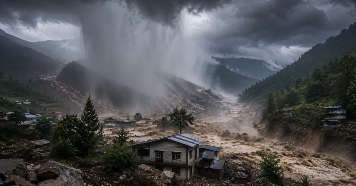

Weather experts can often identify when a region faces favourable conditions for heavy rain, but they cannot always predict the exact village, hillside or valley where a cloudburst will occur.
The problem comes down to scale and speed. A normal heavy-rain forecast may cover an entire district or mountain region for several hours. A cloudburst can develop rapidly, release extreme rain over a very small area and weaken before the wider weather network captures its full intensity.
Heavy-Rain Forecast Is Not a Cloudburst Forecast
A regional rainfall forecast answers a broad question: which areas have a significant chance of receiving heavy rain during a particular period?
Meteorologists study large weather systems, moisture movement, wind patterns, monsoon circulation, atmospheric instability and topography. These observations can show that a state, district or mountain belt faces an increased risk of intense rain.
A cloudburst forecast asks a much harder question: will an exceptionally intense rain cell release around 100 millimetres or more within an hour over one small location?
The first forecast deals with a broad environment. The second requires meteorologists to identify a highly local event before it fully develops.
Weather models may correctly show that thunderstorms will form across a region while placing the strongest cell several kilometres away from where it eventually appears. That small location error may have little effect on a regional rain forecast, but it makes a major difference for a village, road or river catchment.
A forecast can therefore succeed at identifying dangerous weather conditions while failing to pinpoint the exact cloudburst location.
India is also testing new technologies beyond weather monitoring, including the system explained in How India’s First Hydrogen Train Works Without Diesel.
Cloudbursts Affect an Extremely Small Area
The small size of a cloudburst creates one of the greatest forecasting challenges.
A monsoon system can cover several states. A large rain band may extend across hundreds of kilometres. A cloudburst, by comparison, can concentrate its most intense rainfall over only a few square kilometres.
Forecasting systems divide the atmosphere into grid boxes. Each box represents a section of the landscape. Although modern models provide much more detail than older systems, a cloudburst may still form at a scale smaller than the model can represent accurately.
The model may show intense rain across a wider area rather than a concentrated downpour over one valley. It may also smooth out the peak rainfall because the model spreads the estimated rain across an entire grid box.
This produces an important difference between forecasted average rainfall and the amount that may fall at one exact point.
A district may receive moderate rain overall while one isolated slope experiences an extreme downpour. Looking only at the district average can hide the severity of the local event.
The Storm Can Develop Very Quickly
Cloudbursts often form from powerful convective clouds.
Convection begins when warm, moist air rises. As the air climbs, it cools and water vapour condenses into cloud droplets. Strong atmospheric instability can push this air upward rapidly, allowing a tall thundercloud to develop.
Meteorologists can identify conditions that support convection, but they cannot always determine exactly where the strongest upward movement will begin.
A minor local difference can influence storm formation. Slight changes in surface heating, wind direction, moisture or terrain may decide whether a cloud grows slowly, produces ordinary rain or develops into an extreme rain-producing cell.
Once strong convection begins, the storm can intensify quickly. A forecast issued several hours earlier may identify the wider risk without showing the precise location because the decisive local process had not yet developed.
Radar may detect the growing cell later, but by then the event may already be approaching its most dangerous stage.
This leaves forecasters with a narrow window between recognising the cloudburst threat and the start of flooding.
Weather patterns also shape the timing of remarkable insect events, including the synchronized emergence explored in India’s World Cup Cicada and Its Four-Year Life Cycle.
Mountains Make the Atmosphere More Complicated
Cloudbursts frequently affect Himalayan regions, the Western Ghats and other hilly areas because mountains can force moisture-filled air upward.
When monsoon winds encounter a mountain slope, the terrain pushes the air higher. The rising air cools, moisture condenses and clouds grow. If the atmosphere already contains high moisture and instability, the mountain can strengthen rainfall development.
However, terrain does not affect every air current in the same way.
The shape of each valley, slope and ridge can redirect wind. One hillside may force air sharply upward, while a neighbouring valley channels it in a different direction. Local winds may collide, separate or become trapped by surrounding peaks.
Weather models cannot always reproduce every small terrain feature with perfect accuracy. A ridge that appears smooth in a model may contain several real-world slopes and channels that influence where a storm develops.
Mountain weather can also change over short distances. One side of a ridge may receive intense rain while the other remains much drier.
These local effects make it difficult to move from a general warning for a mountain region to an exact cloudburst prediction for one settlement.
Rain Clouds May Remain Over One Location
A severe downpour becomes more dangerous when the rain-producing cloud moves slowly or repeatedly develops over the same area.
Strong winds may carry an ordinary storm away before it releases extreme rainfall over one location. A cloudburst risk increases when local wind patterns keep the storm nearly stationary or continuously feed moisture into the same cell.
Forecasters can estimate wind movement at different heights, but small changes can alter the storm’s direction and speed.
A thunderstorm that was expected to move through a valley may slow down. New cloud cells may also form behind the first one and travel over the same location. Meteorologists sometimes call this repeated movement “training” because the storm cells follow one another like railway coaches.
The wider forecast may show thunderstorms moving across the region, but it may not predict that several intense cells will pass over one small catchment.
This repeated rainfall can overwhelm slopes and streams even when no single cloud appears unusual from a distance.
The rainy season can also create everyday health problems, including the skin irritation covered in How to Treat an Itchy Fungal Rash During Monsoon.
Weather Radars Cannot See Every Location Equally
Doppler weather radar provides some of the most useful information for monitoring intense rain.
Radar sends energy into the atmosphere and studies the signals that return after interacting with raindrops, ice and other particles. Forecasters use this information to estimate where precipitation is forming, how strong it may be and how the storm is moving.
However, radar coverage has limitations.
Mountains can block or weaken the radar beam, creating blind spots behind high terrain. The beam also rises higher above the ground as it travels farther from the radar. At long distances, it may observe the upper part of a storm while missing important processes closer to the surface.
A radar station may detect a strong cloud but struggle to measure how much rain reaches a narrow valley below it.
Radar also estimates rainfall rather than collecting every drop directly. Hail, cloud structure, drop size and terrain can affect the estimate. Meteorologists must compare radar information with rain gauges, satellites and other observations.
A denser radar network can reduce gaps, but mountain geography makes complete low-level coverage difficult.
Rain Gauges Can Miss a Cloudburst Entirely
Rain gauges provide direct measurements at specific locations. They play an important role in confirming whether rainfall reached cloudburst intensity.
The difficulty lies in their spacing.
A cloudburst may release extreme rain between two weather stations. One gauge may record ordinary heavy rain several kilometres away, while the most intense part of the storm falls over an unmonitored slope.
The official measurement may therefore understate what happened at the centre of the event.
This problem also affects later confirmation. Residents may report a cloudburst after a flash flood, but nearby instruments may not show rainfall above the official threshold. In some cases, intense rain occurred outside the monitored locations. In others, a landslide, blocked stream or sudden release of accumulated water may have caused the flood.
Without a gauge or reliable radar estimate at the exact location, experts may struggle to confirm whether a true cloudburst occurred.
Adding more automatic weather stations and high-frequency rain gauges can improve detection, but installing and maintaining them across remote mountain terrain remains challenging.
Satellites Provide a Wide View but Not Perfect Local Detail
Weather satellites help meteorologists follow clouds across large and remote areas. They can show cloud-top temperature, moisture movement and the development of powerful storm systems.
Satellite images become especially useful where ground observations remain limited.
However, satellites mainly observe clouds from above. A very cold and tall cloud top may indicate strong convection, but it does not automatically reveal the exact amount of rain reaching the ground beneath it.
Two clouds with similar appearances may produce different rainfall amounts. Mountain terrain can further complicate the relationship between the cloud and the rain that reaches each slope.
Satellites can identify areas where dangerous storms may be growing, but they cannot always provide street-level or village-level rainfall certainty.
Forecasters receive the best picture when they combine satellite, radar, rain-gauge and atmospheric data. Even then, the small size and short life of a cloudburst leave uncertainty.
Forecasting Models Cannot Reproduce Every Cloud Exactly
Weather models use mathematical equations to simulate how the atmosphere may change. They receive information about temperature, air pressure, humidity, wind and many other conditions.
Even with accurate observations, the atmosphere contains enormous complexity.
Tiny differences in the starting conditions can lead to different thunderstorm outcomes. A slight error in moisture or wind may cause the model to form a storm too early, too late or in the wrong location.
Models also make approximations for atmospheric processes that occur below their grid scale. These processes include cloud-droplet formation, turbulence and small convective currents.
Higher-resolution models provide more detail and can represent individual storm cells better than broad regional models. However, greater detail does not remove all uncertainty.
A model may predict an intense cell near the correct valley but miss the exact slope. Another model may place it farther north. Forecasters often compare several model runs to identify where the risk remains highest.
This produces a probability rather than a guaranteed location.
Nowcasting Helps but It Offers Limited Lead Time
Long-range forecasts examine weather several days ahead. Short-range forecasts cover the next hours or day. Nowcasting focuses on weather developing over the next few minutes to a few hours.
Nowcasting provides the best chance of identifying a cloudburst threat because it uses recent radar, satellite, lightning and surface observations.
Forecasters can watch a storm intensify, estimate its direction and warn areas in its path.
The limitation involves time.
A cloudburst may develop so quickly that authorities receive only a short warning. In mountainous areas, communication challenges can reduce that time further. A warning must travel from the forecasting centre to disaster officials, local authorities and residents before the rainfall or flood reaches them.
Even an accurate nowcast may provide less preparation time than people expect from a normal weather forecast.
This does not make the warning useless. A few minutes can still help officials close a road, move people away from a stream or alert communities downstream. However, nowcasting cannot always provide the long advance notice available for larger and slower weather systems.
Worst Flooding May Occur Away From the Rain
People sometimes assume that the location receiving the heaviest rain will also experience the worst flood.
Mountain catchments can break that connection.
A cloudburst may occur high above a settlement, where few people see the rain. Water then rushes through streams, narrow valleys and drainage channels toward communities at lower elevations.
The downstream area may experience a destructive wall of water even though it received much less rain.
This makes local warning more difficult. Residents may look at the sky above their homes and see no sign of an extreme downpour while water is already collecting upstream.
Forecasters and disaster managers therefore need rainfall information together with knowledge of river channels, soil conditions, slope stability and drainage.
Predicting the cloudburst forms only one part of the challenge. Authorities must also predict where the water and debris will travel.
Why Weather Alerts Cover a Wider Area
An official heavy-rain alert may include several districts even when the most extreme rainfall affects only a small part of one district.
This broader warning does not mean forecasters expect a cloudburst everywhere.
It means the atmosphere supports dangerous rainfall somewhere within the warned region, but meteorologists cannot confidently identify the exact point in advance.
Issuing a narrow warning too early could exclude the location that ultimately receives the heaviest rain. Issuing a broader warning gives more communities a chance to prepare.
The approach inevitably creates false alarms. Some warned areas may receive little rain, while another location experiences the full event.
False alarms can frustrate residents, but uncertainty remains unavoidable when forecasting small, rapidly developing storms. The alternative—waiting until meteorologists know the exact location—may leave too little time for any useful warning.
Can Cloudburst Prediction Improve?
Cloudburst prediction can improve, although complete certainty remains unlikely.
A denser Doppler radar network can monitor more low-level storm development. Faster-scanning radar can update the picture more frequently while a storm intensifies.
Additional automatic weather stations and rain gauges can capture local rainfall that existing instruments miss. Better communication networks can send those observations to forecasting centres without delay.
Higher-resolution weather models can represent terrain and convection in greater detail. Artificial intelligence may also help identify patterns in radar, satellite and historical rainfall data that appear before extreme downpours.
Forecasting improvements must connect with local warning systems. A technically accurate alert has limited value when it does not reach people living near vulnerable streams, roads and slopes.
Real progress therefore requires better detection, faster analysis, clearer warnings and community-level response plans.
What a Heavy-Rain Warning Really Means
A heavy-rain forecast does not promise that every location will receive dangerous rainfall. It signals that the wider atmosphere can produce damaging rain somewhere in the warned area.
Residents in hilly regions should not wait for an alert that names their exact village before taking a warning seriously. Cloudburst-scale precision may remain impossible until the storm has already started developing.
The forecasting gap does not show that meteorologists failed to see the weather system. It shows the difference between recognising a dangerous regional environment and predicting the exact behaviour of one rapidly growing cloud.
Cloudbursts remain difficult to predict because they combine almost every major forecasting challenge: they affect small areas, intensify quickly, interact with complex terrain and can produce flooding far from the heaviest rain.
Weather experts can often see the broader danger coming. Identifying the precise hillside where the atmosphere will release its most intense rain remains the harder problem.
Frequently Asked Questions
Why are cloudbursts so difficult to predict?
Cloudbursts develop quickly, affect very small areas and depend on highly local changes in moisture, wind, temperature and terrain. Forecasting systems may identify the wider risk of heavy rain without locating the exact storm cell in advance.
Can weather agencies predict a cloudburst before it happens?
Forecasters can identify conditions that make cloudbursts more likely, but they often cannot predict the exact location and time. Radar-based nowcasting may detect a rapidly strengthening storm shortly before the event.
Why can heavy rain be forecast but not a cloudburst?
A heavy-rain forecast covers a broad region and longer period. A cloudburst forecast would need to identify an exceptionally intense downpour over one small location, sometimes within a particular hour.

2 thoughts on “How Cloudbursts Form and Why They Are Hard to Predict”